referentie code
IE CA CP/3/16/50/71
Titel
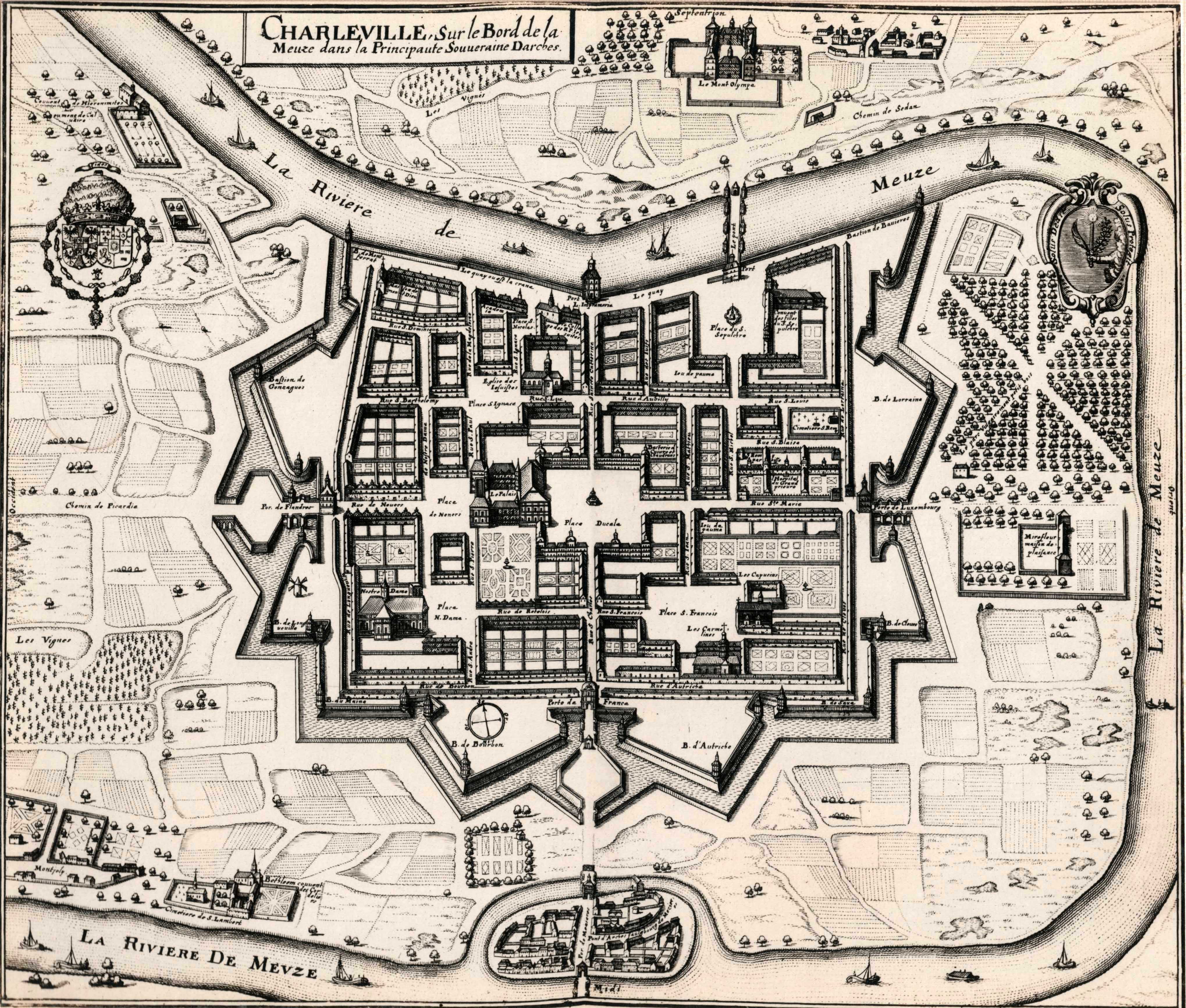
Map of Charleville (Charleville-Mézières), France
Datum(s)
- c.1920 (Vervaardig)
Beschrijvingsniveau
Deel
Omvang en medium
Copy print
Naam van de archiefvormer
(24 November 1900-26 July 1970)
archiefbewaarplaats
Geschiedenis van het archief
Directe bron van verwerving of overbrenging
Bereik en inhoud
A print of a seventeenth-century map of Charleville (now Charleville-Mézières) in France. Charleville was the location where the exiled Irish Capuchins established their first residence in 1615. A manuscript annotation underneath the print in the volume reads ‘Charleville. The home of the Irish Capuchins from 1615 to 1686’. The map was originally published in Matthaeus Merian and Martin Zeiler, ‘Topographia Galliae’ (Frankfort [c.1655-61]).