Cote
IE CA CP/3/16/50/72
Titre
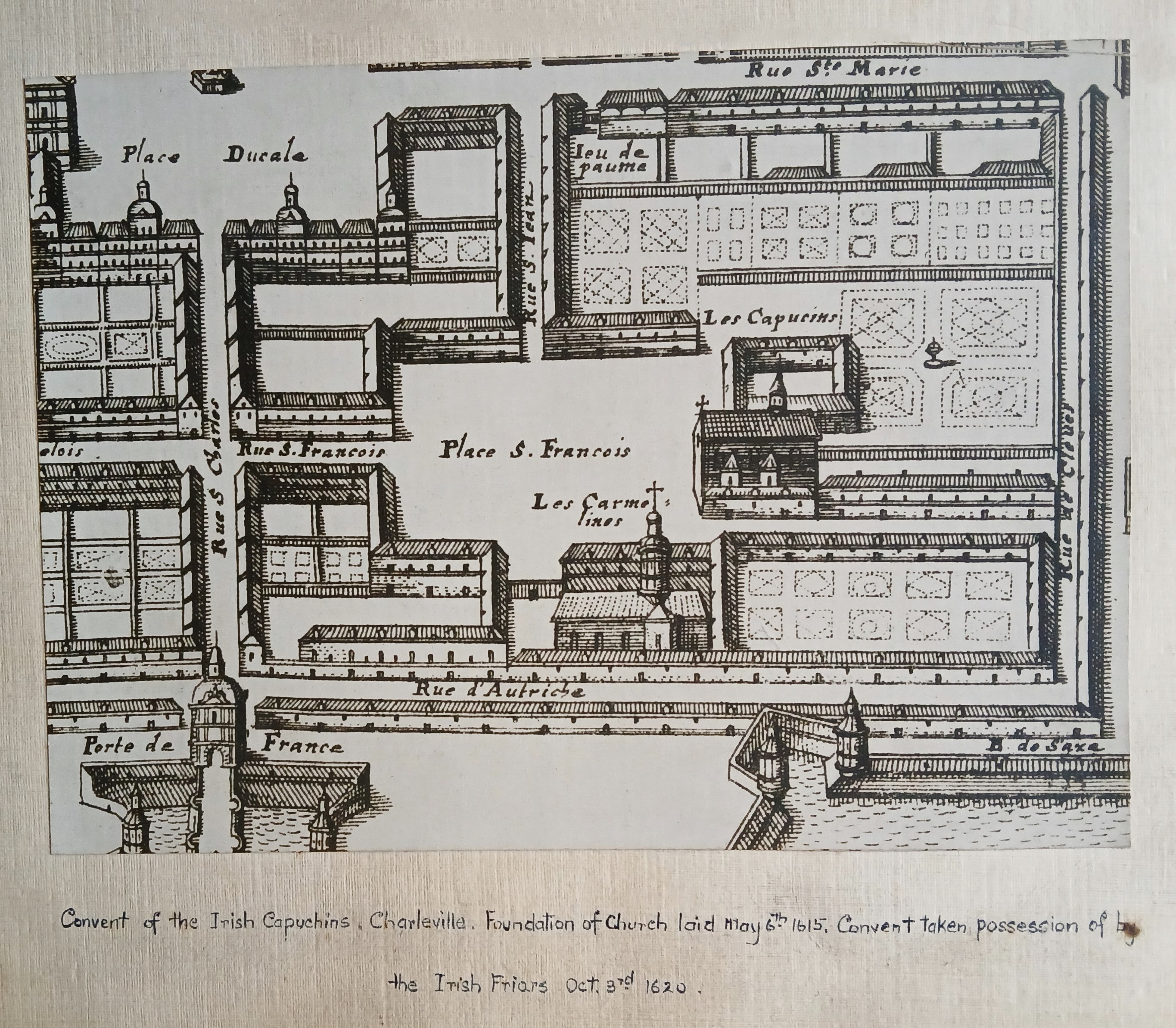
Detail from map of Charleville (Charleville-Mézières), France
Date(s)
- c.1920 (Création/Production)
Niveau de description
Partie
Étendue matérielle et support
Copy print
Nom du producteur
(24 November 1900-26 July 1970)
Histoire archivistique
Source immédiate d'acquisition ou de transfert
Portée et contenu
A print of detail from a seventeenth-century map of Charleville (now Charleville-Mézières) in France, showing the location of the Capuchin friary (‘Les Capucins’) in the town. The foundation for the church and friary was laid on 6 May 1615 and the building was taken possession of by the Irish Capuchins on 3 October 1620. In 1685 the Charleville friary was transferred to the French Capuchins and the Irish friars went to Bar-sur-Aube. The map was originally published in Matthaeus Merian and Martin Zeiler, ‘Topographia Galliae’ (Frankfort [c.1655-61]).