Código de referencia
IE CA HT/2/1/3/1
Título
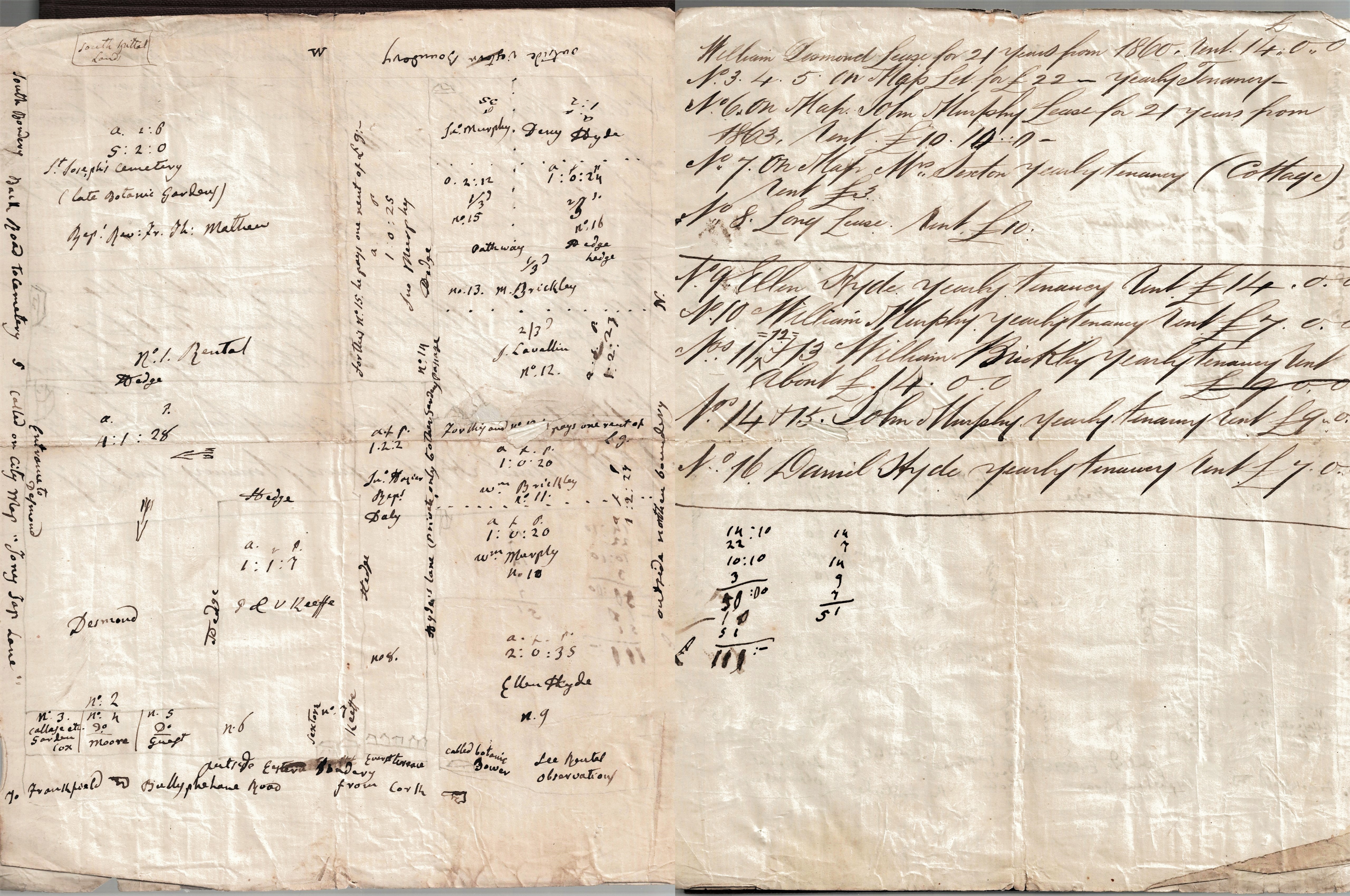
Property Sketch Map and Schedule of Leases for St. Joseph’s Cemetery, Cork
Fecha(s)
- c.1860 (Creación)
Nivel de descripción
Unidad documental simple
Volumen y soporte
3 pp; Manuscript
Nombre del productor
(1615-2023)
Institución archivística
Historia archivística
Origen del ingreso o transferencia
Alcance y contenido
Sketch map of St. Joseph’s Cemetery ‘5 acres 2 roods 0 perches, late botanic gardens, representatives of Rev. Fr. Theobald Mathew’, bordered by ‘South Spittal Lands’ and by ‘the back road to the cemetery called on [the] city map “Tory Top Lane”’. The map also shows various numbered denominations of land possibly on the former Botanic Gardens' site. A numbered schedule of deeds and lease (nos. 3-16), possibly relating to the aforementioned site, is extant on the reverse of the sketch map.