

Identificatie
referentie code
Titel
Datum(s)
- 7 Oct. 1968 (Vervaardig)
Beschrijvingsniveau
Omvang en medium
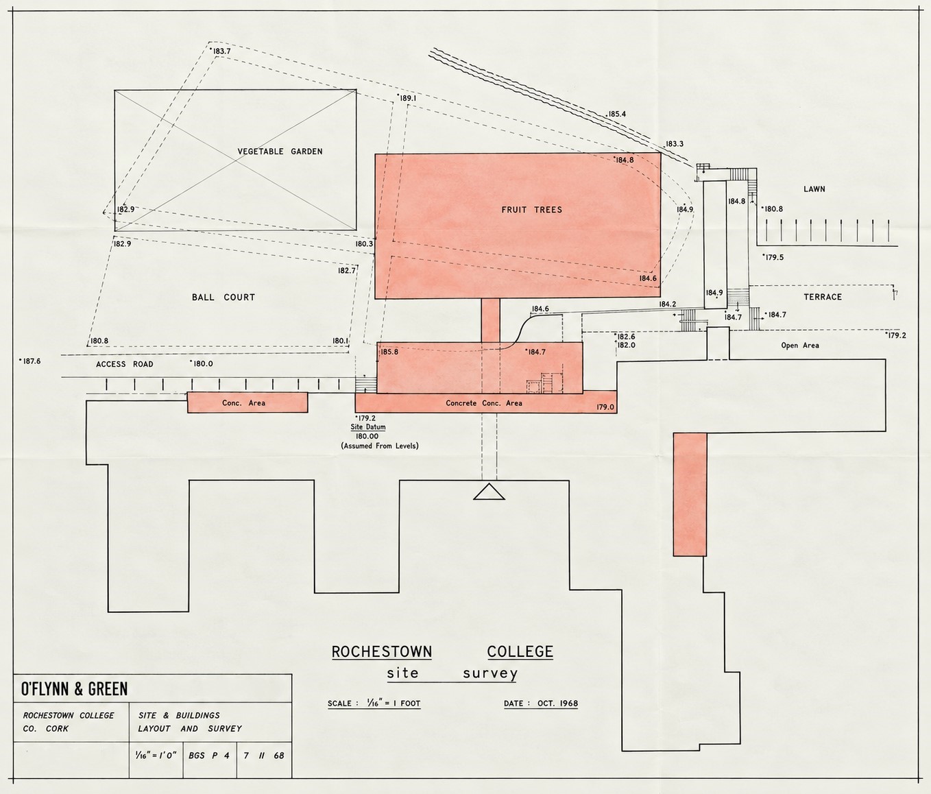
64 cm x 55 cm; architectural drawing on paper; features black ink line work, hand-written text, and coral-red watercolour wash
Context
Naam van de archiefvormer
archiefbewaarplaats
Geschiedenis van het archief
Directe bron van verwerving of overbrenging
Inhoud en structuur
Bereik en inhoud
A hand-coloured architectural site survey map titled ‘Rochestown College Site Survey’ detailing the existing school structures, proposed additions, and surrounding campus landscape plots at Rochestown College, County Cork, designed by O’Flynn & Green Architects. Rendered at a scale of 1/16 inch to one foot, the document illustrates the spatial footprint of the main institutional complex alongside recreational and agricultural zones. The layout delineates the main footprint of the main school building blocks at the bottom of the map, mapping adjacent infrastructural elevations, an access path, an ‘Access Road’, a ‘Ball Alley’, a rectangular ‘Vegetable Garden’, a large ‘Fruit Garden’, and the ‘Grotto’. Specific building footprints and proposed extensions are prominently emphasized across the plot survey using a coral-red watercolour wash.