Cote
IE CA CS/2/5/4
Titre
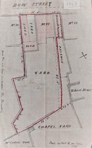
Plan of 21 Bow Street
Date(s)
- c.1867 (Création/Production)
Niveau de description
Pièce
Étendue matérielle et support
22 cm x 13.5 cm; Ink with colour washes on linen paper
Nom du producteur
(1615-2023)
Histoire archivistique
Source immédiate d'acquisition ou de transfert
Portée et contenu
Scale: 20 feet to 1 inch
Plan delineating the boundary of demised house, yards and shed at 21 Bow Street. The plot is bounded to north by 22 Bow Street, a passage way and a school house, and to the east by the Chapel Yard and Curtins’ Yard. The frontage onto Bow Street measures 38 feet 4 inches. An annotation in the left-hand margin of the plan reads: ‘The red line indicates the boundary’.

