Zone d'identification
Cote
IE CA WA/7/2/13
Titre
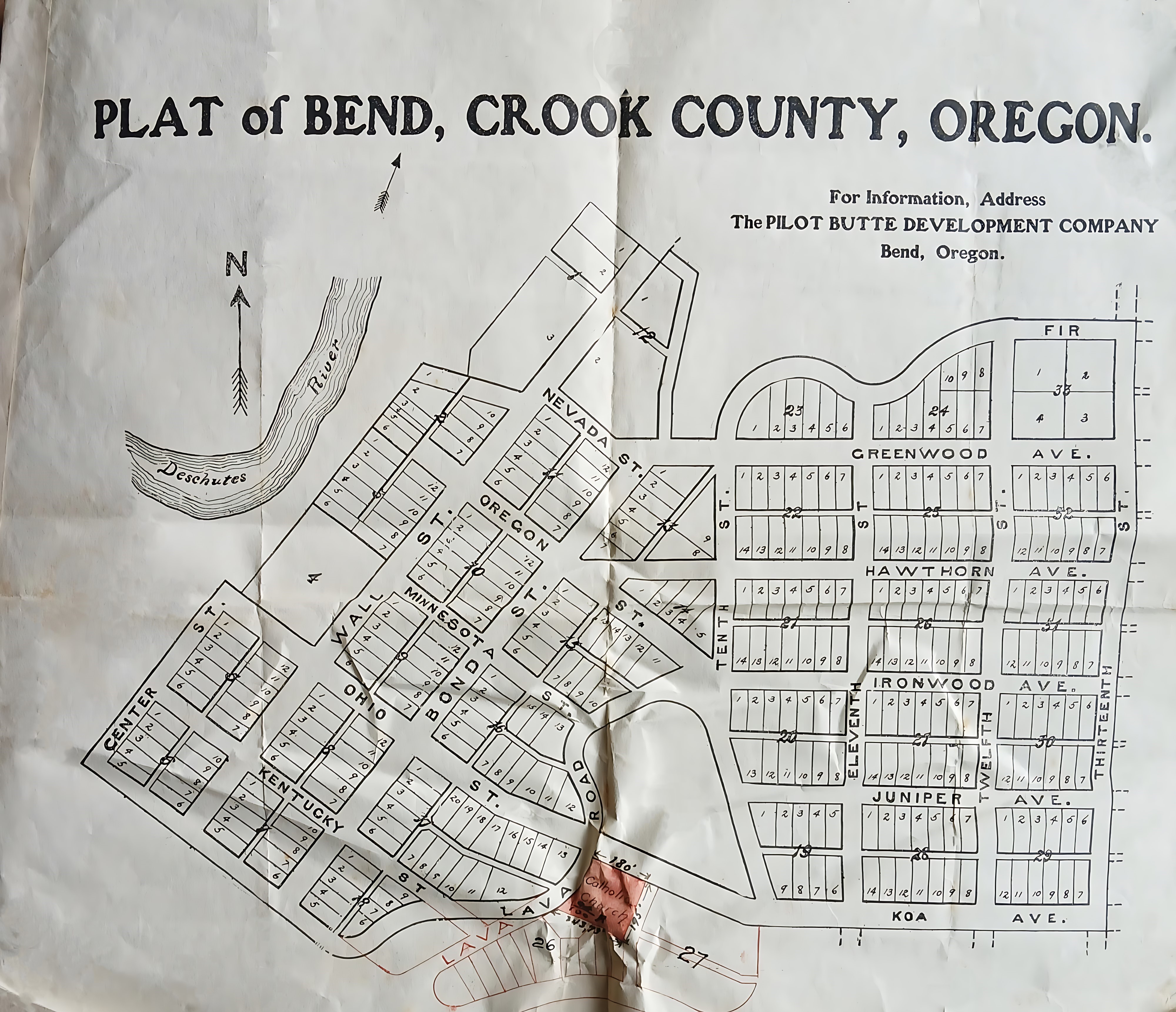
Urban Plan of Bend, Oregon
Date(s)
- c.1910 (Création/Production)
Niveau de description
Pièce
Étendue matérielle et support
32 cm x 28 cm; printed
Zone du contexte
Nom du producteur
(1615-2023)
Histoire archivistique
Source immédiate d'acquisition ou de transfert
Zone du contenu et de la structure
Portée et contenu
An urban plat map of Bend, Oregon, published by the Pilot Butte Development Company when the city was still part of Crook County. The map details the town’s initial downtown grid layout, surrounding residential avenues, and the path of the Deschutes River. A specific triangular parcel at the bottom centre near Lava Road features handwritten red shading and a pencil inscription marking it as ‘Catholic Church Property’.