Área de identidad
Código de referencia
IE CA WA/8/5
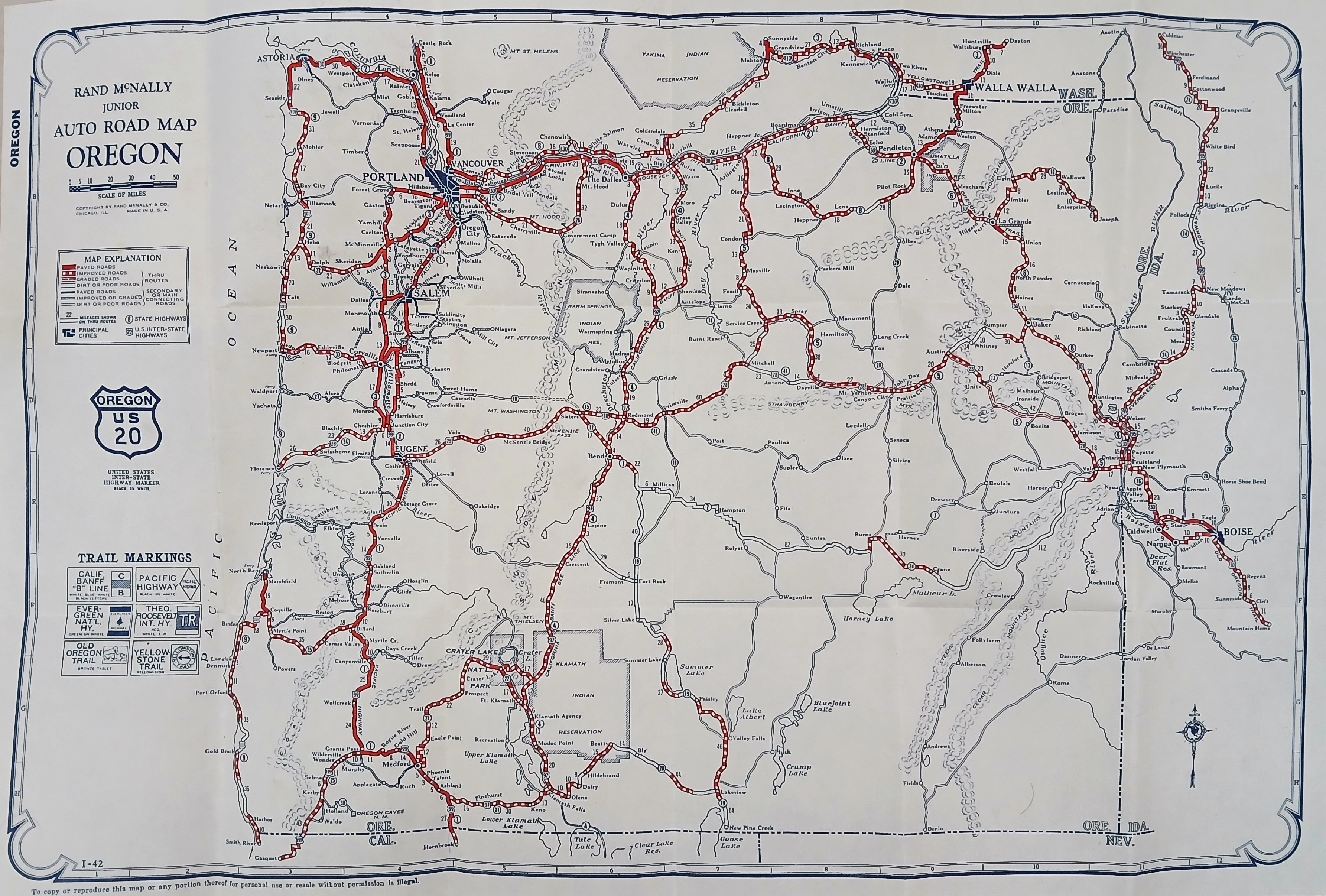
Título
Road Map of Oregon
Fecha(s)
- c.1940 (Creación)
Nivel de descripción
Unidad documental simple
Volumen y soporte
64 cm x 48 cm; printed
Área de contexto
Nombre del productor
(1615-2023)
Institución archivística
Historia archivística
Origen del ingreso o transferencia
Área de contenido y estructura
Alcance y contenido
A ‘Rand McNally Junior Auto Road Map of Oregon’ illustrating the automobile transit network. Main highways are highlighted as a web of bold red routes connecting primary hubs like Portland, Salem, Eugene, and Medford, flanked by the Pacific Ocean coastline to the west and the Columbia River to the north. Key natural features, including Crater Lake and various mountain peaks, are mapped across the interior terrain.