Zone d'identification
Cote
IE CA WA/8/3
Titre
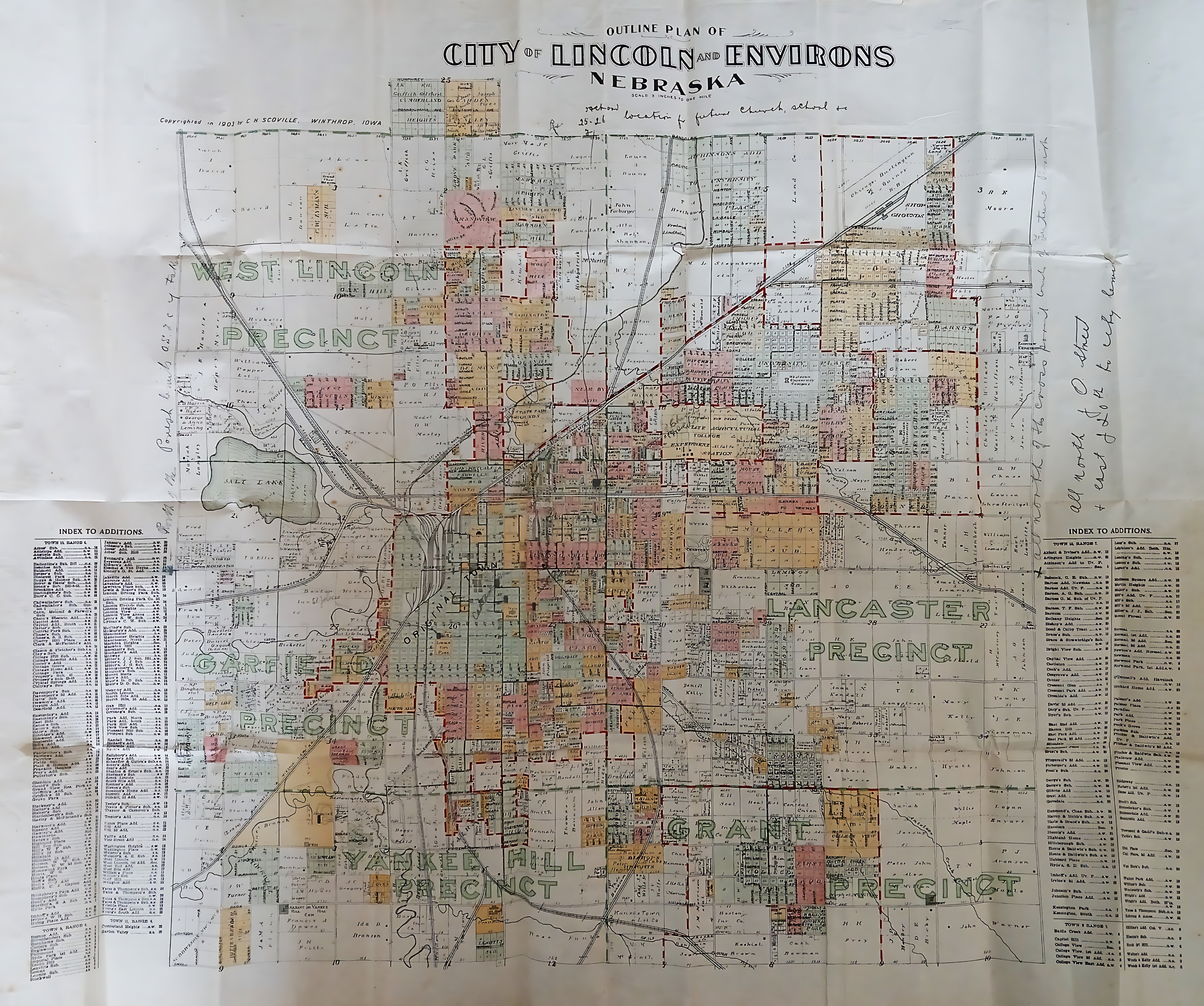
Outline Plan of City of Lincoln and Environs, Nebraska
Date(s)
- c.1919 (Création/Production)
Niveau de description
Pièce
Étendue matérielle et support
110 cm x 100 cm; printed
Zone du contexte
Nom du producteur
(1615-2023)
Histoire archivistique
Source immédiate d'acquisition ou de transfert
Zone du contenu et de la structure
Portée et contenu
A printed map titled ‘Outline Plan of City of Lincoln and Environs, Nebraska’ and carrying a 1901 copyright by C.W. Scoville. The map uses distinct colour blocks to separate various real estate developments and precincts, including West Lincoln Precinct, Garfield Precinct, Yankee Hill Precinct, Grant Precinct, and Lancaster Precinct. There are two pencil notations on the map’s margins. Along the top edge near the title, the text notes a specific location for a ‘future church & school …’. On the right margin, another pencil note specifies geographic boundaries, reading ‘all north of O street & east of 20th to city line’.