Área de identidad
Código de referencia
IE CA WA/8/1
Título
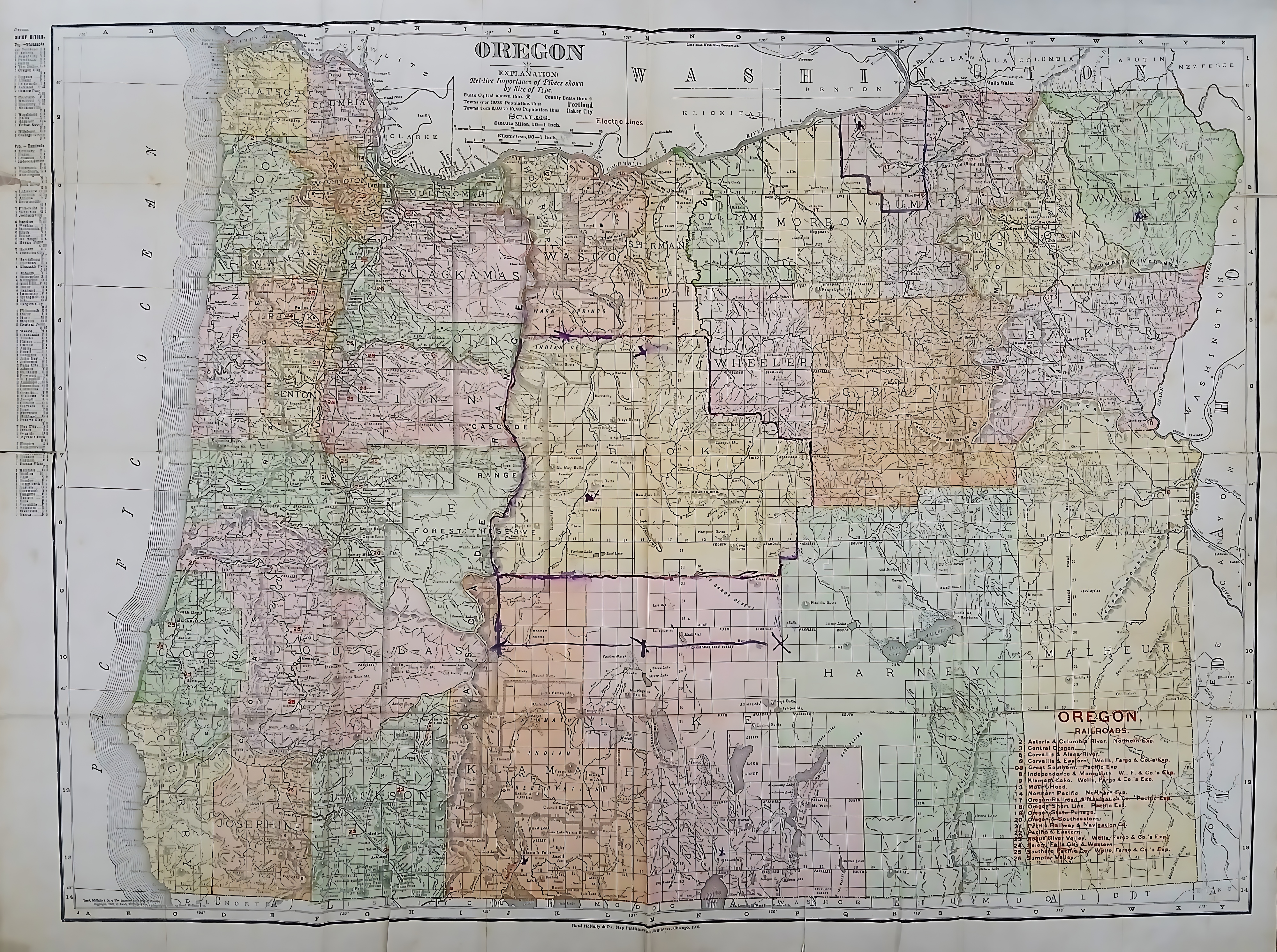
Map of the State of Oregon
Fecha(s)
- c.1910 (Creación)
Nivel de descripción
Unidad documental simple
Volumen y soporte
112 x 105 cm; printed
Área de contexto
Nombre del productor
(1615-2023)
Institución archivística
Historia archivística
Origen del ingreso o transferencia
Área de contenido y estructura
Alcance y contenido
A color-coded map of Oregon, partitioning it into early county configurations rendered in pastel shades. The northern border tracks the winding Columbia River alongside Washington, while the left edge meets the Pacific Ocean. A prominent, hand-drawn purple ink line with small ‘X’ marks carves an L-shaped territory through central counties like Crook and Harney. These marked territories likely align with areas assigned to the Irish Capuchin friars for their early missionary work.