Zone d'identification
Cote
IE CA WA/8/2
Titre
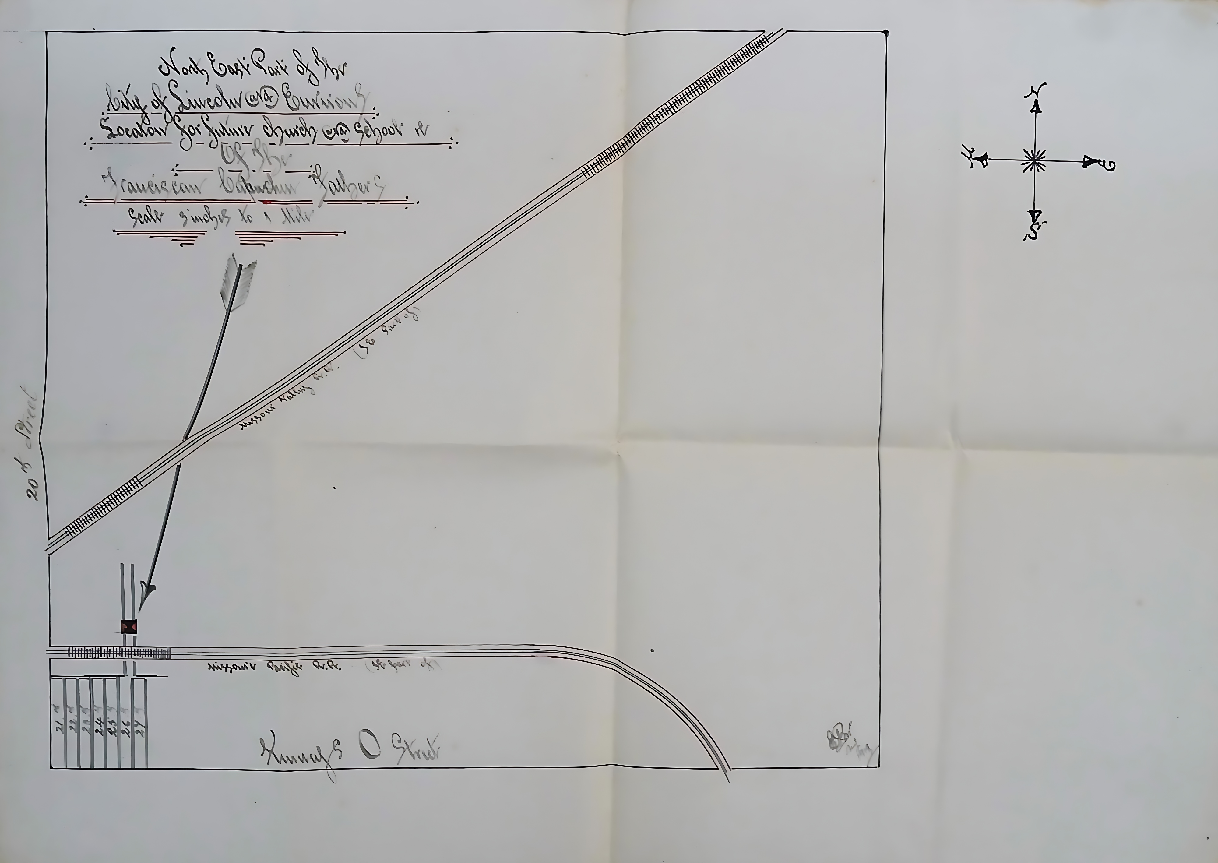
Map of proposed location for Church and School in Lincoln, Nebraska
Date(s)
- 1919 (Création/Production)
Niveau de description
Pièce
Étendue matérielle et support
51 cm x 40 cm; manuscript
Zone du contexte
Nom du producteur
(1615-2023)
Histoire archivistique
Source immédiate d'acquisition ou de transfert
Zone du contenu et de la structure
Portée et contenu
A hand-drawn plat map depicting the northeastern part of the city of Lincoln, Nebraska, and its surrounding areas, specifically outlining a proposed location for a future church and school for the Capuchin Fathers. The map is drawn at a scale of three inches to one mile.