Área de identidad
Código de referencia
IE CA WA/8/2
Título
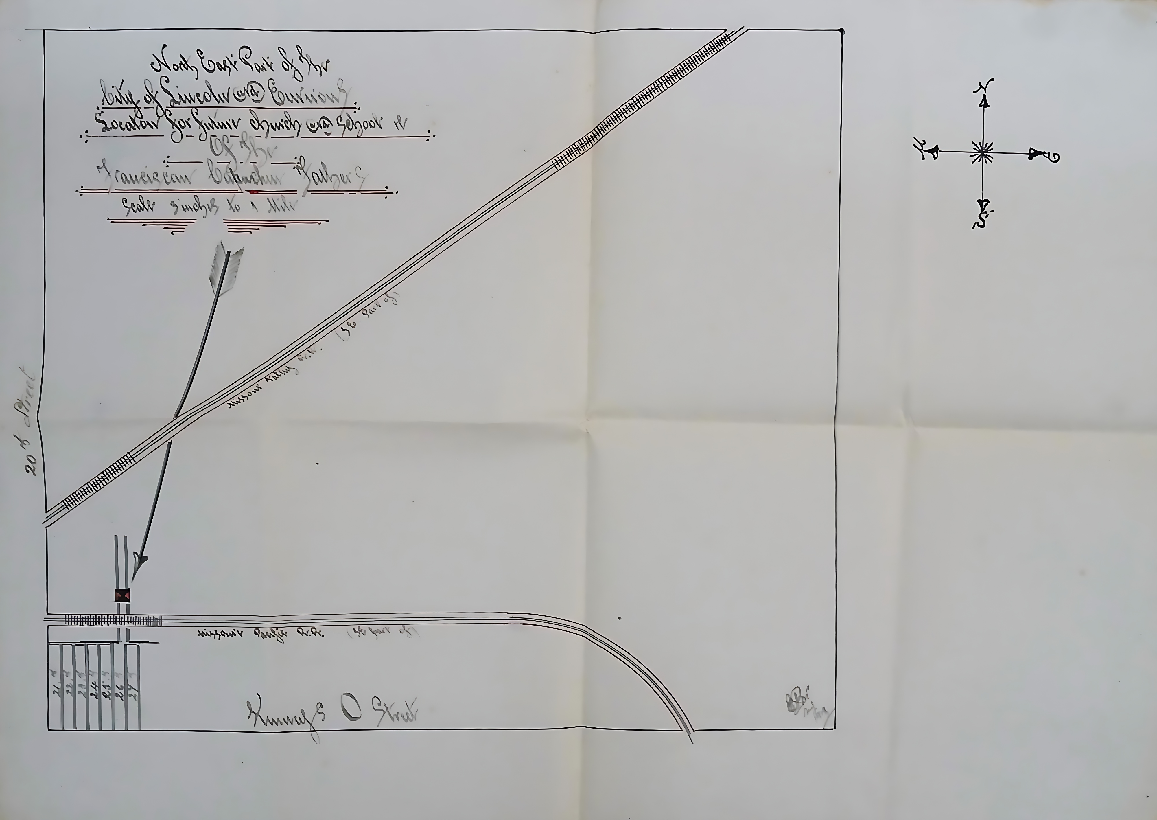
Map of proposed location for Church and School in Lincoln, Nebraska
Fecha(s)
- 1919 (Creación)
Nivel de descripción
Unidad documental simple
Volumen y soporte
51 cm x 40 cm; manuscript
Área de contexto
Nombre del productor
(1615-2023)
Institución archivística
Historia archivística
Origen del ingreso o transferencia
Área de contenido y estructura
Alcance y contenido
A hand-drawn plat map depicting the northeastern part of the city of Lincoln, Nebraska, and its surrounding areas, specifically outlining a proposed location for a future church and school for the Capuchin Fathers. The map is drawn at a scale of three inches to one mile.