Identificatie
referentie code
IE CA WA/8/4
Titel
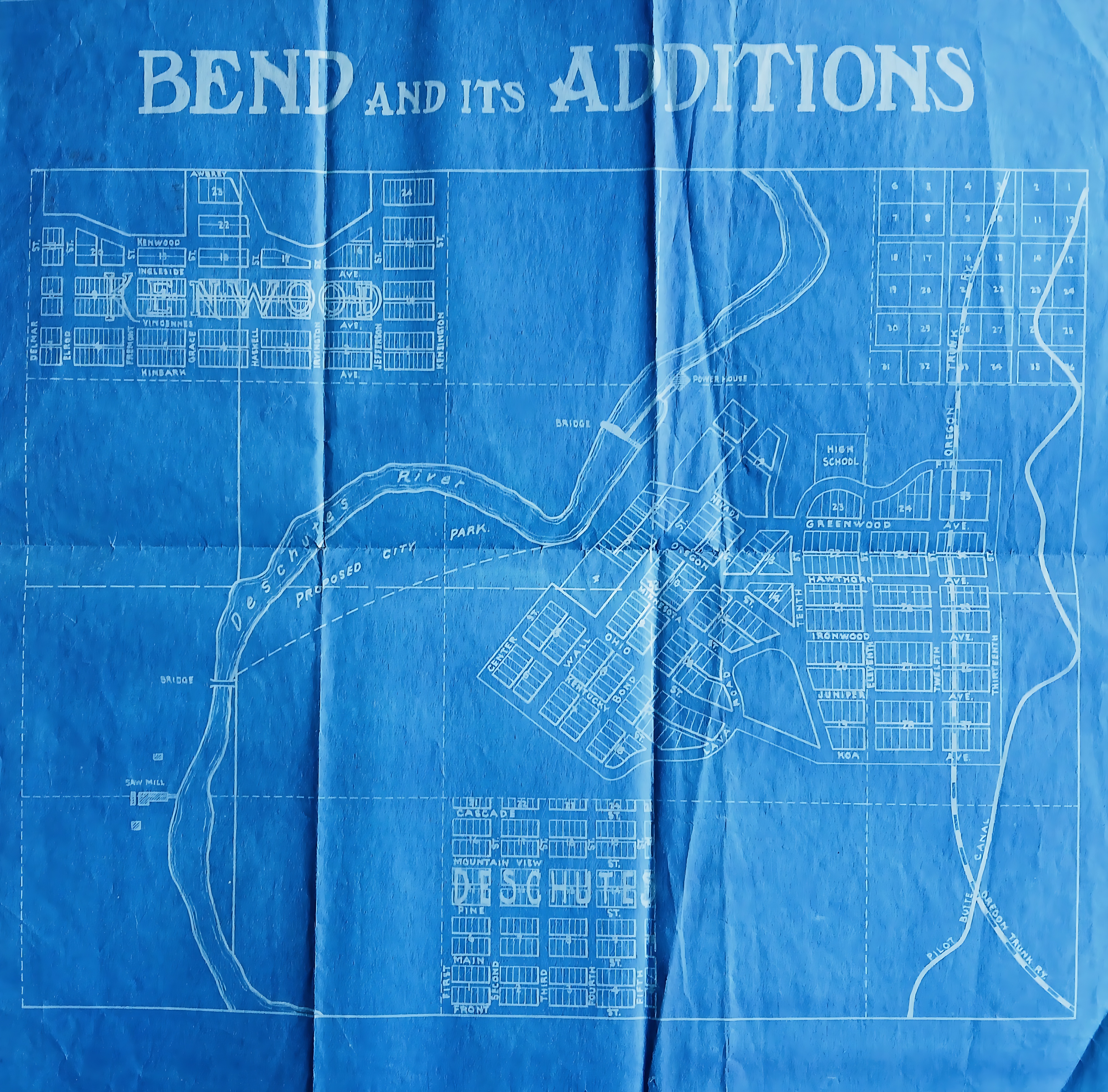
Map of Bend, Oregon
Datum(s)
- c.1920 (Vervaardig)
Beschrijvingsniveau
Stuk
Omvang en medium
46 cm x 40 cm; printed
Context
Naam van de archiefvormer
(1615-2023)
archiefbewaarplaats
Geschiedenis van het archief
Directe bron van verwerving of overbrenging
Inhoud en structuur
Bereik en inhoud
A blueprint map, titled ‘Bend and its additions’ outlining the early urban layout and real estate development of Bend, Oregon. The Deschutes River snakes through the centre of the plan, bounded by a designated ‘Proposed City Park’, a local sawmill, and a downstream powerhouse. Neighbourhoods like Kenwood to the northwest and Deschutes to the south are marked. The eastern edge maps transit infrastructure, showing the vertical corridor of the Oregon Trunk Railway alongside the Pilot Butte Canal.