Zone d'identification
Cote
IE CA WA/8/4
Titre
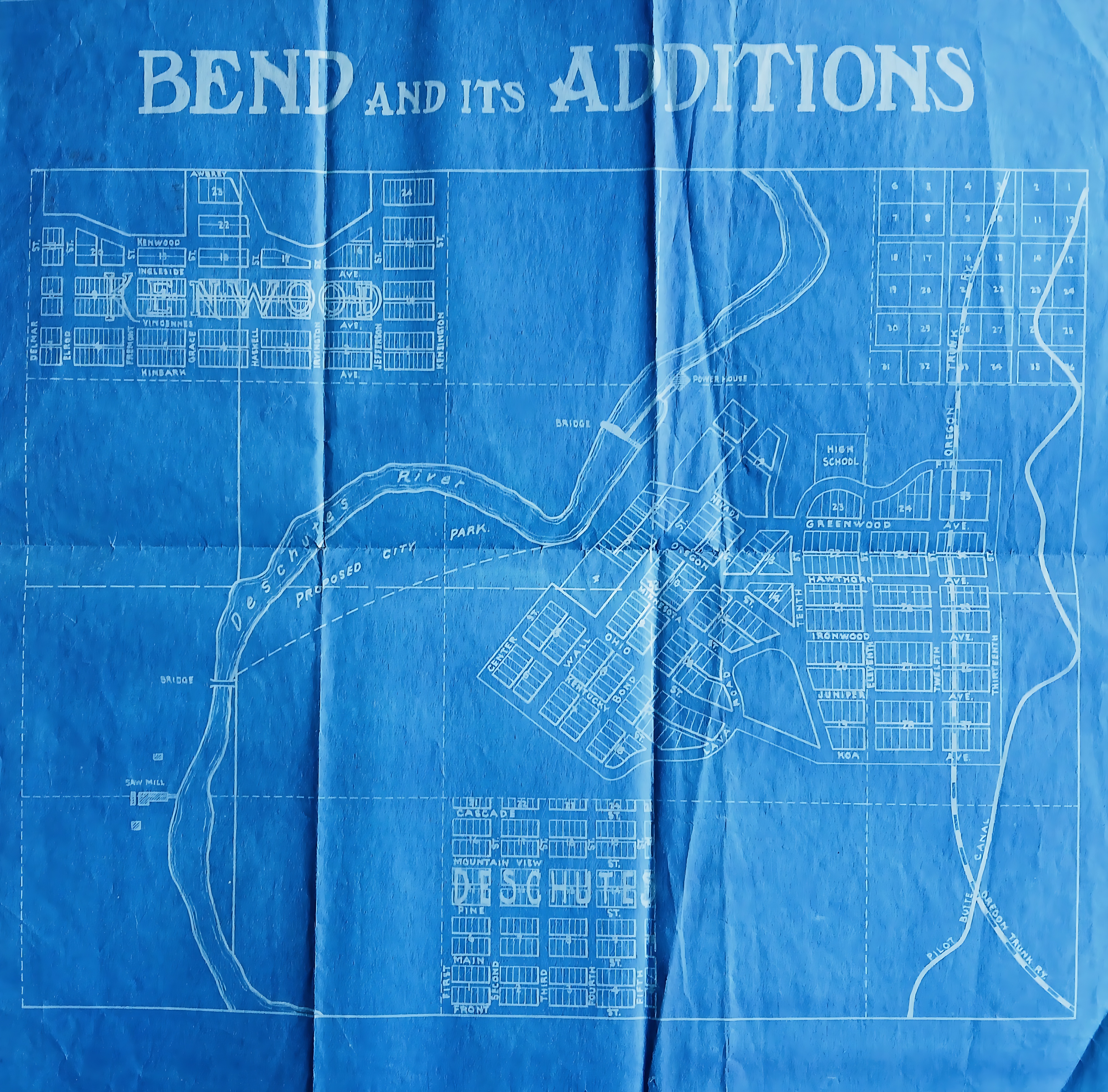
Map of Bend, Oregon
Date(s)
- c.1920 (Création/Production)
Niveau de description
Pièce
Étendue matérielle et support
46 cm x 40 cm; printed
Zone du contexte
Nom du producteur
(1615-2023)
Histoire archivistique
Source immédiate d'acquisition ou de transfert
Zone du contenu et de la structure
Portée et contenu
A blueprint map, titled ‘Bend and its additions’ outlining the early urban layout and real estate development of Bend, Oregon. The Deschutes River snakes through the centre of the plan, bounded by a designated ‘Proposed City Park’, a local sawmill, and a downstream powerhouse. Neighbourhoods like Kenwood to the northwest and Deschutes to the south are marked. The eastern edge maps transit infrastructure, showing the vertical corridor of the Oregon Trunk Railway alongside the Pilot Butte Canal.