Imprimir vista previa Cerrar

Mostrando 845 resultados

Descripción archivística
Irish Capuchin Archives Irish Capuchin Archives Unidad documental simple Con objetos digitales
Imprimir vista previa Hierarchy Ver :

The Capuchins’ Missions

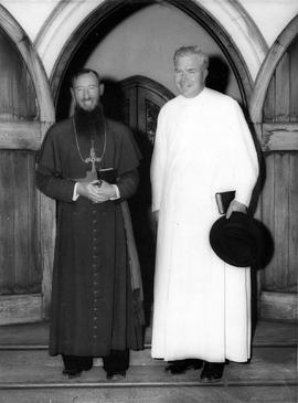
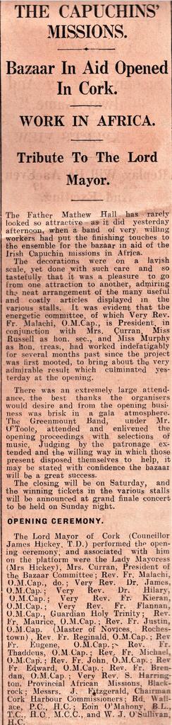
Cutting from the 'Cork Examiner', 20 Oct. 1938, reporting on the opening of a bazaar in Father Mathew Hall, Cork, to aid the work of the Capuchin African missions.

Zambezi Mission

Publication by Fr. Owen O’Sullivan OFM Cap. on the history of the Irish Capuchins in Zambia, 1931-1981 ([Zambia, 1982]). The chapter headings include: the pioneers; the land and its people in a changing world; a beginning is made; working through schools; the friars’ conditions; progress step by step and stone by stone.

Architectural Plan of Parow Church, Cape Town

No scale given
Sectional plan and front-view elevation of the proposed Church of the Immaculate Conception in Parow, Cape Town, South Africa. The plan is initialed ‘GA’ and is dated 19 January 1935.

St. Mary of the Angels, Athlone, Cape Town

A view of building work on the Church of St. Mary of the Angels in Athlone parish, Cape Town, South Africa. The print is annotated on the reverse: ‘The unfinished school and chapel at Athlone, Cape Flats’.

Property Sketch Map and Schedule of Leases for St. Joseph’s Cemetery, Cork

Sketch map of St. Joseph’s Cemetery ‘5 acres 2 roods 0 perches, late botanic gardens, representatives of Rev. Fr. Theobald Mathew’, bordered by ‘South Spittal Lands’ and by ‘the back road to the cemetery called on [the] city map “Tory Top Lane”’. The map also shows various numbered denominations of land possibly on the former Botanic Gardens' site. A numbered schedule of deeds and lease (nos. 3-16), possibly relating to the aforementioned site, is extant on the reverse of the sketch map.

Letter re Fishing Rights

Letter from Hugh A. Law (1872-1943), Marble Hill, County Donegal, to Fr. Colman Griffin OFM Cap., guardian, Ard Mhuire Friary, seeking permission to place trout fry in a lake located on the friary estate.

Map of the Prefecture of Victoria Falls

A map of the Prefecture of Victoria Falls showing the locations of Irish Capuchin mission stations in 1950. The former place names are given in brackets such as Kaoma (formerly Mankoya).

Resultados 791 a 800 de 845