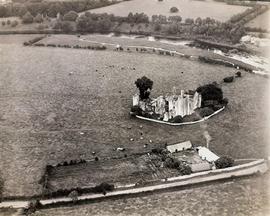
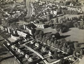
An aerial view of Bective Abbey, a ruined Cistercian abbey on the banks of the River Boyne in County Meath. An annotation on the reverse of the print reads 'Army Air Corps / 10 September 1931 / Bective Abbey / Lens: 8½ inch'.
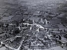
An aerial view of Carlow Town in about 1945. Prominent buildings in the image include (in the foreground) the Cathedral of the Assumption. Work on this Gothic-Revival style building commenced in 1828 and it was completed in 1833. The cathedral’s 151 feet (46 metre) spire is a conspicuous landmark in the town. Adjacent to the cathedral is St. Patrick’s College, a former seminary for the diocese of Kildare and Leighlin, and now a liberal arts and humanities college for lay students. The English-born architect Thomas Alfred Cobden (1794-1842) was responsible for the design of the college’s south wing (1817-1819) and north wing (1821-1835) and later the adjoining cathedral. Near the River Barrow adjoining Wellington Bridge (better known as Graiguecullen Bridge) are the ruins of Carlow Castle.
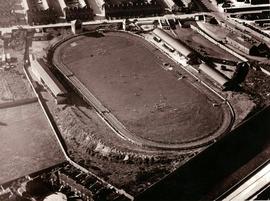
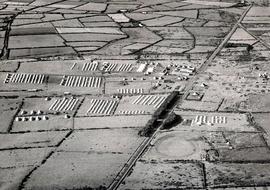
An aerial view of Shelbourne Park Football Stadium in Ringsend, Dublin, in September 1936. The print forms part of a series of photographs taken by the Irish Army Air Corps for the Geological Survey of Ireland.
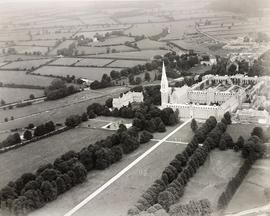
An aerial view of St. Patrick's College in Maynooth in County Kildare. The image shows Stoyte House, the College Chapel and St. Joseph's Square on what is now the South Campus of Maynooth University.