Showing 4346 results

Archival description
With digital objects
Print preview Hierarchy View:

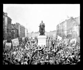
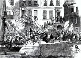
Father Mathew departs Cork for America

A plate showing a print of Fr. Theobald Mathew OSFC departing Cork for his American temperance campaign in 1848. The print is taken from 'The Illustrated London News'. The plate is by T. Mayne & Son, Dublin.

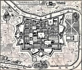
Map and Views of Charleville (now Charleville-Mézières) and Sedan, France

The file comprises ‘The Imperial Dry Plate Co., Ltd., Cricklewood, London’ box. The box contains three plates. One of the plates shows an image of a seventeenth century map of the town of Charleville (now Charleville-Mézières) in the Ardennes Department in Northern France. The map shows the location of the church and friary established by the exiled Irish Capuchins in Charleville in the early seventeenth century. The map is titled ‘Charleville sur le Bord de la Meuze dans la Principaute Souuerain Darches’. The map has been attributed to Edmé Moreau (1596-1648). The file also includes topographic views of the walled cities of Sedan and Tovl. A faint ink stamp of the British Museum is visible on the Sedan view. Includes a cover letter from Alan Macbeth, photographers, affirming that the prints were sourced from the ‘Zeillers Topographie Gallae’ collection in the British Museum. The letter is dated 2 January 1920.

Map of Galway (c.1651)

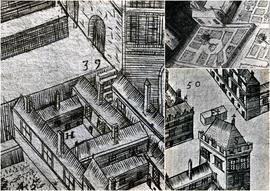
A file containing ‘Wellington Plates’ box. The box holds four plates showing details from a pictorial map of Galway (c.1651). Two known copies of the original seventeenth century map exist, one in Trinity College Library in Dublin, and the second in the James Hardiman Library in NUI Galway.

The numbered map details include references to the following:

H. This is described on the map as the ‘Residentia Capuchinorum’. It represents a block of buildings on the north side of Great Gate Street in an area now known as Williamsgate Street. It sits under one of the Great Gates of the city (marked as ‘30’). It is most likely the location of the rented house occupied by the Capuchins in 1644 when they left the Collegiate buildings of St. Nicholas.

F. This indicates the altar erected by the Capuchins for public processions along the main thoroughfare running through Galway. The altar was situated at a place now popularly referred to as the ‘The Four Corners’, at one of which is the well-known fourteenth century stone townhouse called Lynch’s Castle (marked as ‘S’).

Number '8' on the map is a reference to a church, a block of buildings and an ornamental garden with walks. It is referred to on the map as ‘Capuchinorum Aedes’. It is situated outside the city walls and stands on the north side of Bohermore – now known as Prospect Hill. It is located near the old Pigeon House (marked as ‘42’). This is most likely the church and friary built by the Capuchins when they vacated their rented house in 1644. The site of this church is now occupied by The Western Hotel.

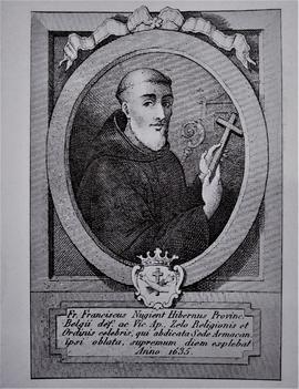
Fr. Francis Nugent OSFC (1569-1635)

A plate showing an image of a seventeenth-century print of Fr. Francis Nugent OSFC (1569-1635), the founder of the Irish Capuchin Franciscan Province. The plate is by Mayne, Lord Edward Street, Dublin.

Newspaper Clippings

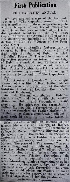
A collection of newspaper clippings and articles assembled by the editors of 'The Capuchin Annual'. Some of the clippings relate to the roles played by various Capuchin friars in events associated with the Irish Revolution. Other newspaper and magazine clippings include articles reviewing and critiquing various editions of the 'Annual'.

Sunday Independent

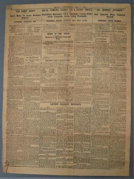
The articles refer to attempts to secure a truce between Free State forces and republican irregulars in order to ‘avert a national disaster’.

Results 1001 to 1010 of 4346