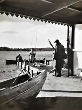
Fishing on Lough Derg, County Tipperary
- IE CA CP/1/1/3/13/15
- Part
- c.1960
Part of Irish Capuchin Archives
A view of a fishing party on the shores of Lough Derg in County Tipperary in about 1960.
Fishing on Lough Derg, County Tipperary
Part of Irish Capuchin Archives
A view of a fishing party on the shores of Lough Derg in County Tipperary in about 1960.
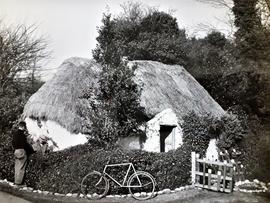
Thatched Cottage, Lusk, County Dublin
Part of Irish Capuchin Archives
A view of traditional thatched cottage near Lusk in County Dublin in about 1960. An annotation on the reverse reads 'Thatched cottage near Lusk / The last of the Greater Commons'.
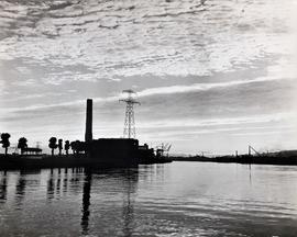
Marina Generating Station, Cork
Part of Irish Capuchin Archives
A view of the Marina electricity generating station on the south bank of the River Lee in Cork. Commissioned in 1954, the station is situated in the city's docklands close to Páirc Uí Chaoimh and to the former Ford factory site. The station was closed in September 2018.
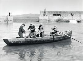
Fishermen, Helvick Head Harbour, County Waterford
Part of Irish Capuchin Archives
A view of fishermen at work at Helvick Head Harbour in County Waterford in about 1960. An annotation on the reverse of the print reads ‘Mackerel men / Helvick, County Waterford’.
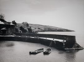
Part of Irish Capuchin Archives
A view of the harbour pier at Glandore in County Cork in about 1960.
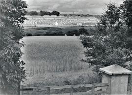
Part of Irish Capuchin Archives
A view of the Hennessy's Road and Slievekeale areas of Waterford city. A typescript annotation on the reverse of the print reads 'Rus in Urba / Ballybricken, Waterford'.
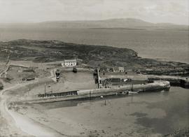
North Harbour, Cape Clear Island, County Cork
Part of Irish Capuchin Archives
A view of North Harbour on Cape Clear, Ireland's most southerly island, situated about ten kilometres off the south-west coast of County Cork. A typescript annotation on the reverse of the print reads 'Harbour, Cape Clear / Roaring Water Bay / and Mount Gabriel'.
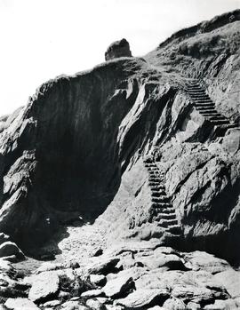
Garretstown Cliffs, County Cork
Part of Irish Capuchin Archives
A view of the cliffs on Garretstown beach in County Cork. A typescript annotation on the reverse of the print reads 'Garrestown, County Cork / The Smugglers' Steps'.
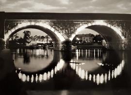
Carrick-on-Shannon Bridge, County Leitrim
Part of Irish Capuchin Archives
A view of the five-arch limestone road bridge crossing the River Shannon at Carrick-on-Shannon in County Leitrim.
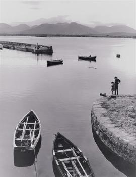
Roundstone Harbour, County Galway
Part of Irish Capuchin Archives
A view of the small harbour at Roundstone, Connemara, County Galway, in about 1960. Roundstone (in Irish, ‘Cloch na Rón’, meaning ‘seal’s rock’) was built in the 1820s by Alexander Nimmo (1783-1832), a Scottish civil engineer who had settled in the locality.