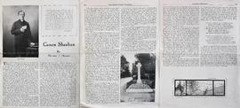
Map and Views of Charleville (now Charleville-Mézières) and Sedan, France
- IE CA PH/3/25
- File
- 1920
Part of Irish Capuchin Archives
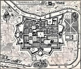
The file comprises ‘The Imperial Dry Plate Co., Ltd., Cricklewood, London’ box. The box contains three plates. One of the plates shows an image of a seventeenth century map of the town of Charleville (now Charleville-Mézières) in the Ardennes Department in Northern France. The map shows the location of the church and friary established by the exiled Irish Capuchins in Charleville in the early seventeenth century. The map is titled ‘Charleville sur le Bord de la Meuze dans la Principaute Souuerain Darches’. The map has been attributed to Edmé Moreau (1596-1648). The file also includes topographic views of the walled cities of Sedan and Tovl. A faint ink stamp of the British Museum is visible on the Sedan view. Includes a cover letter from Alan Macbeth, photographers, affirming that the prints were sourced from the ‘Zeillers Topographie Gallae’ collection in the British Museum. The letter is dated 2 January 1920.