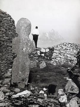
A view of the ruins of the monastic settlement on Skellig Michael (also known as Great Skellig) off the Iveragh Peninsula in County Kerry. A typescript annotation on the reverse of the print notes that the image shows ‘St. Michael’s Oratory and Abbot’s Cross on the Great Skellig’.
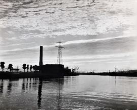
A view of the Marina electricity generating station on the south bank of the River Lee in Cork. Commissioned in 1954, the station is situated in the city's docklands close to Páirc Uí Chaoimh and to the former Ford factory site. The station was closed in September 2018.
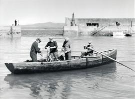
A view of fishermen at work at Helvick Head Harbour in County Waterford in about 1960. An annotation on the reverse of the print reads ‘Mackerel men / Helvick, County Waterford’.
A view of the Hennessy's Road and Slievekeale areas of Waterford city. A typescript annotation on the reverse of the print reads 'Rus in Urba / Ballybricken, Waterford'.
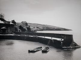
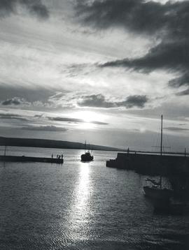
A view of North Harbour on Cape Clear, Ireland's most southerly island, situated about ten kilometres off the south-west coast of County Cork. A typescript annotation on the reverse of the print reads 'Harbour, Cape Clear / Roaring Water Bay / and Mount Gabriel'.
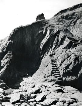
A view of the cliffs on Garretstown beach in County Cork. A typescript annotation on the reverse of the print reads 'Garrestown, County Cork / The Smugglers' Steps'.
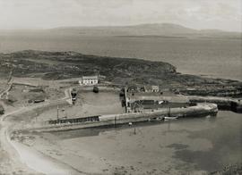
An image of fishing vessel entering Baile na nGall Harbour, Ring (An Rinn), in County Waterford. A typescript annotation on the reverse of the print reads 'Baile na nGall, Ring, County Waterford'.