- IE CA AMI/1/8
- Deelreeks
- 1936-1988
Part of Irish Capuchin Archives
4465 results with digital objects Show results with digital objects
Part of Irish Capuchin Archives
Part of Irish Capuchin Archives
A tourist guide to the attractions of Cape Town and the Western Cape, South Africa. With maps.
A Crime against humanity / Apartheid in South Africa
Part of Irish Capuchin Archives
A pamphlet condemning the system of apartheid enforced by the Government of South Africa. Published by the Information Service of the United Nations.
Part of Irish Capuchin Archives
Scale: 4 miles to 1 inch
The Royal Automobile Club of South Africa / Map of the Cape Peninsula. The map has been annotated (in red ink) with the locations and names of Irish Capuchin missions in the Cape Province (Parow, Langa and Claremont).
Irish Capuchin Missions in the Cape Province
Part of Irish Capuchin Archives
No scale given
Hand-drawn map of Irish Capuchin missions in the suburbs around Cape Town, South Africa. The map shows the locations of Claremont, Parow, and Athlone in addition to other major settlements around the Cape Flats and on the Cape Peninsula. The map has been extensively annotated. It reads: ‘The purely white parishes would be Sea Point, Rondebosch, Mowbray, Woodstock (mostly so). The other places have a quota of whites, mostly coloured though. My ambition is to get ourselves quartered in the part marked in heavy read. … All the coloured are moving towards the Flats especially along the main road towards Bellville’.
Part of Irish Capuchin Archives
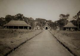
A view of St. Joseph’s Mission in Mankoya in Northern Rhodesia.
Part of Irish Capuchin Archives
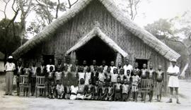
Catechumens at Mankoya mission in Northern Rhodesia.
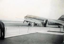
Aer-Lingus DC-3 at Shannon Airport
Part of Irish Capuchin Archives
An image of an Aer-Lingus DC-3 aircraft at Shannon Airport in County Clare.
Part of Irish Capuchin Archives
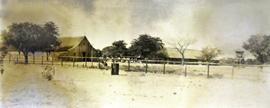
A view of Sancta Maria mission station at Lukulu in Northern Rhodesia.
Part of Irish Capuchin Archives
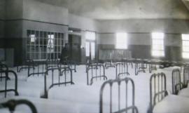
An image of the interior of the dormitory at Parow, Cape Town, South Africa.