Ordinations, Ard Mhuire Friary
- IE CA DL/5/11/9
- Unidad documental simple
- c.1950
Parte deIrish Capuchin Archives
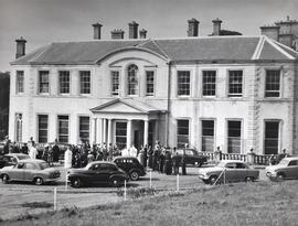
A view of a crowd assembled outside Ard Mhuire Capuchin Friary following an ordination ceremony,
Ordinations, Ard Mhuire Friary
Parte deIrish Capuchin Archives
A view of a crowd assembled outside Ard Mhuire Capuchin Friary following an ordination ceremony,
Marian Statue, Ard Mhuire Friary
Parte deIrish Capuchin Archives
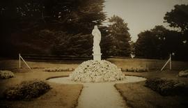
An image of the statue of the Blessed Virgin Mary which stood in front of Ard Mhuire Capuchin Friary in County Donegal.
Aerial View of Ard Mhuire Friary
Parte deIrish Capuchin Archives
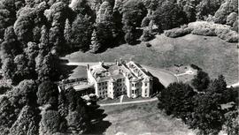
An aerial view of Ard Mhuire Capuchin Friary (formerly Ards House) in County Donegal.
St. Eunan’s College, Letterkenny, County Donegal
Parte deIrish Capuchin Archives
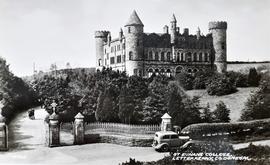
Postcard print of the exterior of St. Eunan’s College, Letterkenny, County Donegal.
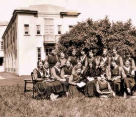
Boarders at Coláiste Bríghde, Falcarragh
Parte deIrish Capuchin Archives
Photographic print of the female boarders at Coláiste Bríghde, Falcarragh, County Donegal. Coláiste Bríghde was one of four preparatory colleges founded between 1926 and 1929 to provide secondary education for aspiring primary school teachers. A manuscript annotation on the reverse reads ‘Coláiste Bríghde, Falcarragh, c.1944 / Chaplain, Fr. Danny Molloy’.
Parte deIrish Capuchin Archives
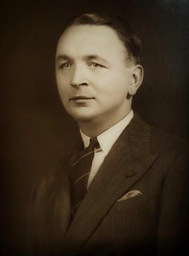
Studio photographic print of Pieter Stewart Bam (1914-2001). The portrait print is autographed. An annotation on the reverse reads: ‘Mr. Pieter Stewart Bam, son of the former owners of Ards House. Portrait presented by himself on occasion of his visit. Jan. 23rd 1949’.
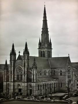
St. Eunan’s Cathedral, Letterkenny, County Donegal
Parte deIrish Capuchin Archives
Photographic print of the exterior of St. Eunan’s Cathedral, Letterkenny, County Donegal.
Photographic Album of the Ard Mhuire Community
Parte deIrish Capuchin Archives
Bound volume containing photographic prints of student friars at the Ard Mhuire House of Studies. Some of the prints are captioned. The album includes images of student friars at work (potato harvesting, bailing hay and routine household work) and at recreation (theatrical plays, weekend retreats, sleighing on snow-covered hills, and visits to the beach). Locations visited by the friars include Burtonport, Errigal Mountain, Aranmore, Doe Castle, Fanad and Kindrum. The album contains several views of Ard Mhuire Friary (formerly Ards House) and surrounding gardens. A small number of prints show friars examining what appears to be un-exploded ordnance on the shoreline. Other prints show ordinations at Ard Mhuire in 1955. Fr. Eustace McSweeney OFM Cap. and Fr. Donal O’Mahony OFM Cap. are present in some of the prints.
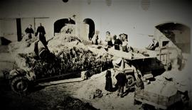
Parte deIrish Capuchin Archives
An image of Capuchin friars and other individuals harvesting at Ard Mhuire Friary in County Donegal.
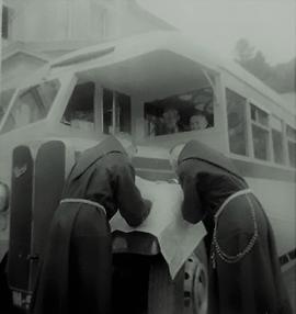
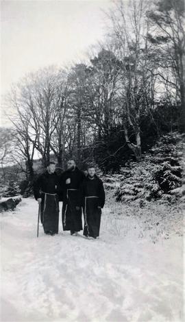
Excursion to Fanad, County Donegal
Parte deIrish Capuchin Archives
An image of Capuchin friars during an excursion to the Fanad peninsula on the north coast of County Donegal.