Mostrando 190 resultados

Descripción archivística
Con objetos digitales Glass Plate Negative and Lantern Slide Collection
Imprimir vista previa Hierarchy Ver :

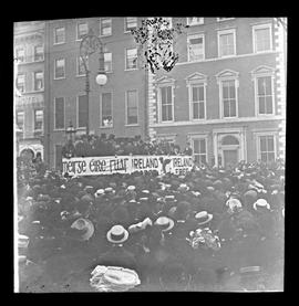
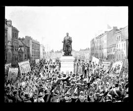
Temperance Demonstration

A view of a temperance demonstration on Sackville (O'Connell) Street in Dublin. A large crowd is assembled in front of a packed platform draped in a large banner reading ‘Ireland Sober Ireland Free’. Fr. Aloysius Travers OSFC is seated in the front row on the platform.

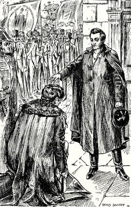
Father Mathew and Daniel O'Connell

A lantern slide showing a print of Fr. Theobald Mathew OSFC giving a blessing to Daniel O’Connell. The plate is by T. Mayne & Son, Dublin. The drawing is by Denis Santry (1879-1960).

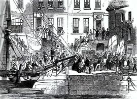
Father Mathew departs Cork for America

A plate showing a print of Fr. Theobald Mathew OSFC departing Cork for his American temperance campaign in 1848. The print is taken from 'The Illustrated London News'. The plate is by T. Mayne & Son, Dublin.

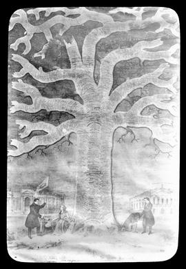
Historical Tree of Ireland

A lantern slide of a print titled ‘the historical tree of Ireland’. The print shows Daniel O’Connell addressing Erin and a cleric (most likely Fr. Theobald Mathew OSFC) delivering a blessing at the base of a tree. The tree itself is inscribed with notable events in Irish and British history such as 'Cromwell's Usurpation'.

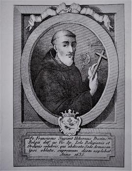
Fr. Francis Nugent OSFC (1569-1635)

A plate showing an image of a seventeenth-century print of Fr. Francis Nugent OSFC (1569-1635), the founder of the Irish Capuchin Franciscan Province. The plate is by Mayne, Lord Edward Street, Dublin.

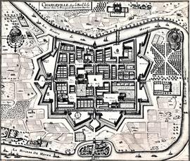
Map and Views of Charleville (now Charleville-Mézières) and Sedan, France

The file comprises ‘The Imperial Dry Plate Co., Ltd., Cricklewood, London’ box. The box contains three plates. One of the plates shows an image of a seventeenth century map of the town of Charleville (now Charleville-Mézières) in the Ardennes Department in Northern France. The map shows the location of the church and friary established by the exiled Irish Capuchins in Charleville in the early seventeenth century. The map is titled ‘Charleville sur le Bord de la Meuze dans la Principaute Souuerain Darches’. The map has been attributed to Edmé Moreau (1596-1648). The file also includes topographic views of the walled cities of Sedan and Tovl. A faint ink stamp of the British Museum is visible on the Sedan view. Includes a cover letter from Alan Macbeth, photographers, affirming that the prints were sourced from the ‘Zeillers Topographie Gallae’ collection in the British Museum. The letter is dated 2 January 1920.

Resultados 51 a 60 de 190